Koridor · Vegetation Risk Detection
Catch vegetation threats before the outage happens
With every new observation, each span's tree height, clearance to the conductor, growth rate and vitality value are read; risk types and severity are determined automatically.
Frameworks we map to
- EUDR
- FSC®
- PEFC
- SBP
- ISO 14001
- GRI
- KVKK
- GeoJSON
- EU Information System (TRACES)
- WGS84
- CSV / REST API
- ISO 27001 control mapping
Vegetation Risk Detection
Four risk types
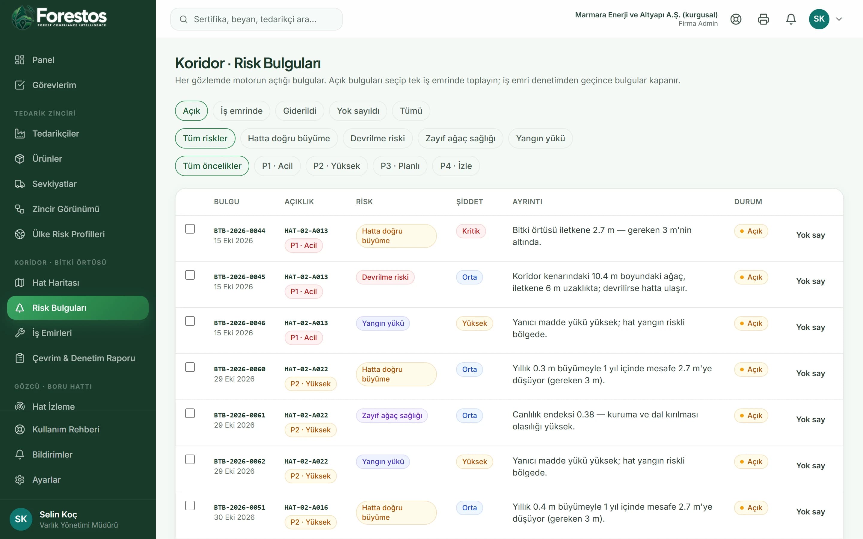
Grow-in (clearance falls below the required clearance given the growth rate), fall-in (the tree is tall enough to reach the line), poor tree health (vitality below the threshold) and fire fuel (weighted more heavily in fire-risk zones).
In the app
- /koridor
- /koridor/bulgular
After logging in you reach these screens from the menu (the app interface is in Turkish).
Findings list
Filter by type, status and priority; open a work order directly from the findings you select.
In the app
- /koridor
- /koridor/bulgular
After logging in you reach these screens from the menu (the app interface is in Turkish).
Work with Vegetation Risk Detection confidently and at scale
When a new observation is taken, every span is re-scored and new findings are opened. Taking a second observation on the same day does not duplicate records.
The Koridor toolset
Not just Vegetation Risk Detection: the whole flow
Frequently asked questions
Frequently asked questions about Vegetation Risk Detection.
Would you like a short introductory call?
Get in touchWhere does the observation data come from?
In the demo environment no satellite provider is connected; observation series are generated synthetically and the screens say so plainly. In a live installation the provider you choose plugs into the same interface.
Who sets the required clearance?
The minimum required clearance and the current cycle year are defined on each line's record; the engine works with these values.