
Menşe · Precision Deforestation Analysis
See what matters. Filter out the noise.
Frameworks we map to
- EUDR
- FSC®
- PEFC
- SBP
- ISO 14001
- GRI
- KVKK
- GeoJSON
- EU Information System (TRACES)
- WGS84
- CSV / REST API
- ISO 27001 control mapping
Precision Deforestation Analysis
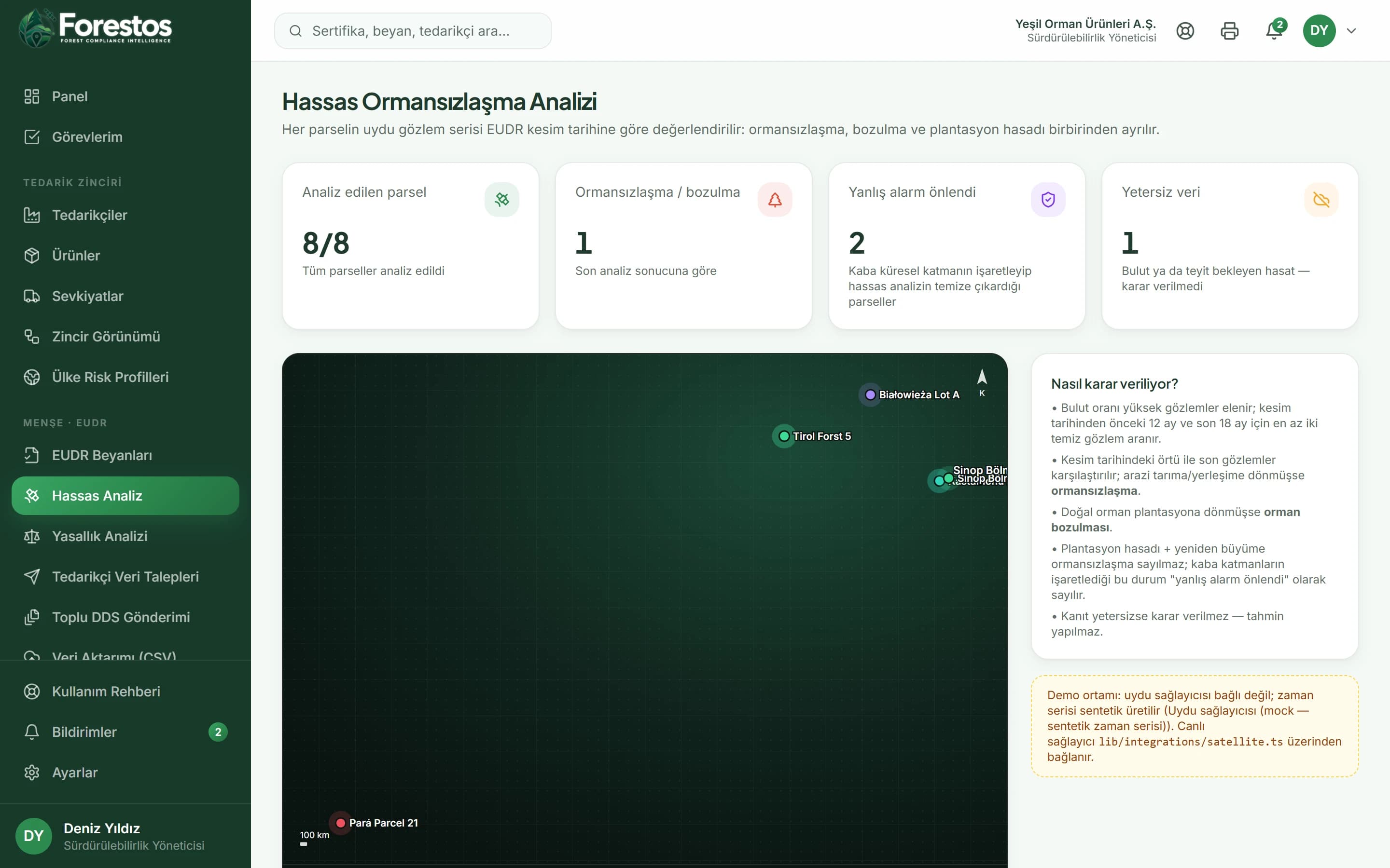
Decision rules that understand the EUDR definitions
- If there are not enough cloud-free observations before and after the cut-off date, no verdict is given: 'insufficient data'.
- Every step of the verdict is stored as reasoning lines (in Turkish, the app's interface language).
- Earlier analyses of the same plot are visible in its history.
In the app
- /eudr/analiz
- /eudr/analiz/[parsel]
After logging in you reach these screens from the menu (the app interface is in Turkish).
One click, in bulk or automatic
In the app
- /eudr/analiz
- /eudr/analiz/[parsel]
After logging in you reach these screens from the menu (the app interface is in Turkish).
Work with Precision Deforestation Analysis confidently and at scale
The Menşe toolset
Not just Precision Deforestation Analysis: the whole flow
Menşe
Country-of-Origin Legality Review
Checklist against the law of the country of origin, plus expert review
Menşe
ERP & API Integration
Plot, order and analysis flow via CSV and REST API
Menşe
Due Diligence Statements & TRACES
Bulk approval, submission and reference checks
Menşe
Supplier Data Requests
Data requests by link, instant geolocation validation
Frequently asked questions
Frequently asked questions about Precision Deforestation Analysis.
Would you like a short introductory call?
Get in touchHow do you determine whether deforestation happened after the cut-off date?
Tree cover and land class are determined from the cloud-free observations closest to the cut-off date in the plot's series and compared with later observations. If a lasting drop below the forest threshold and a non-forest land class are seen together, the verdict is deforestation.
How do you tell plantation harvesting apart from deforestation?
If cover grows back after felling and the land class stays plantation/forest, the verdict is 'harvest + regrowth'. For these plots the screen states that a coarse loss layer would raise an alert, and why the verdict differs.
Which satellite data do you use?
In the demo environment no satellite provider is connected; observation series are generated synthetically and the screens say so plainly. In a live installation the provider you choose plugs into the same interface.
Is the result recognised by an authority?
Menşe's analysis is evidence for your due diligence, not an official approval. The reasoning behind the verdict and the observation series are stored in a form you can show to an auditor.