
Pipeline monitoring
Spot pipeline risks before they happen
Frameworks we map to
Demo scenarios- EUDR
- FSC®
- PEFC
- SBP
- ISO 14001
- GRI
- KVKK
- GeoJSON
- EU Information System (TRACES)
- WGS84
- CSV / REST API
- ISO 27001 control mapping
Traditional monitoring leaves too much unseen
Threats go unnoticed
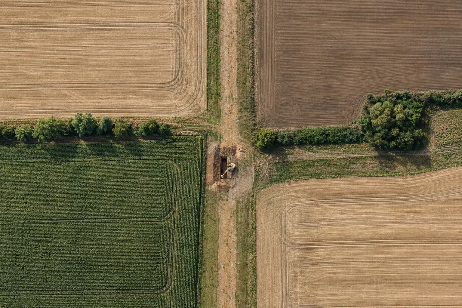
Excavation or construction that starts between patrols isn't seen until the damage is done.
Many alerts, little action
When every change arrives with the same priority, teams miss the real threat.
No single source of truth
Detection, field visit and closure are kept in different places; the trail can't be followed in an audit.
Let's set up a pilot on your route
- Importing route and segment data
- Defining the corridor width and sensitive areas
- A first detection list and case flow
For pipeline operators, continuous awareness
Gözcü gathers every step from detection to closure in a single case.
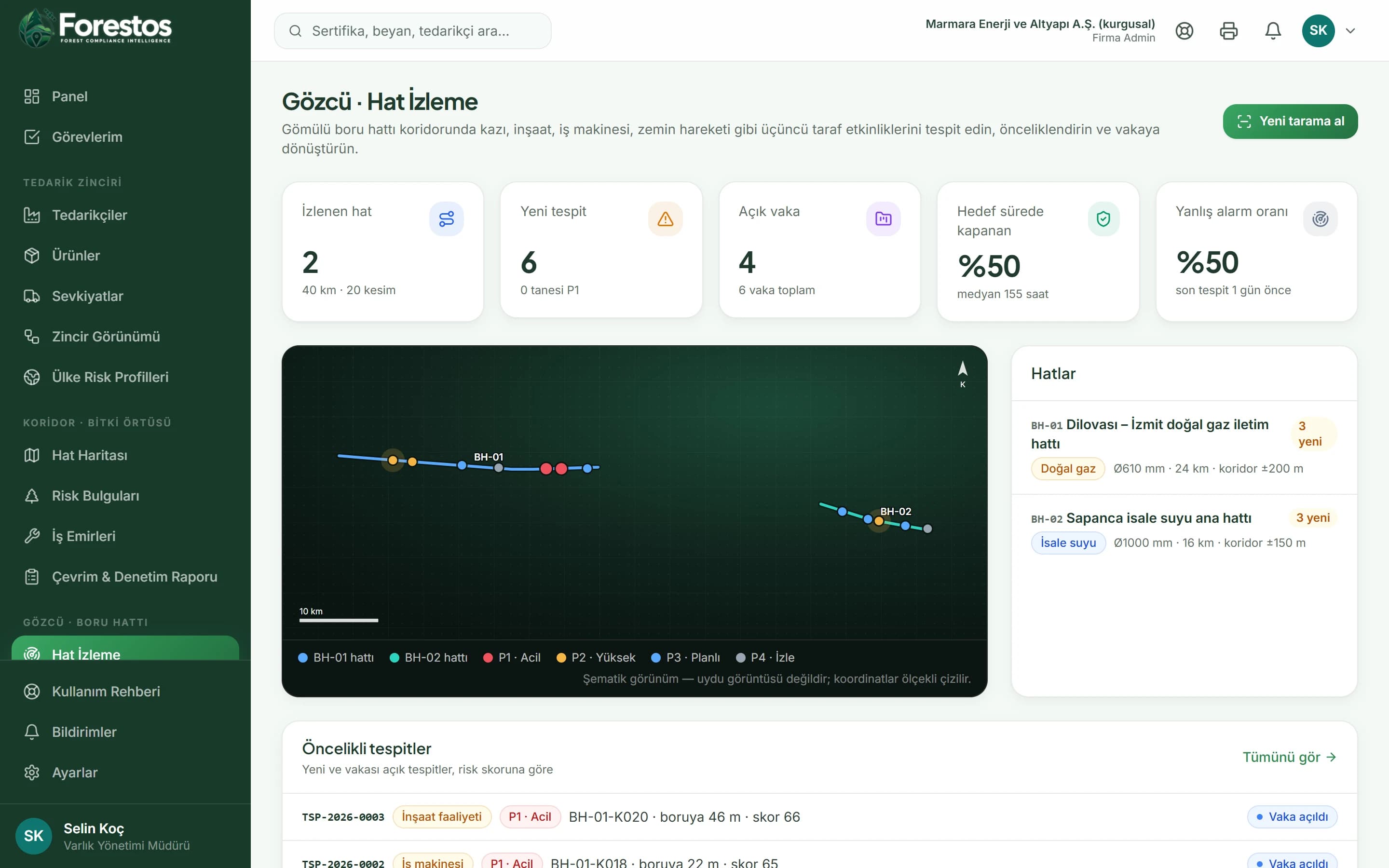
Catch risks before they become incidents
Threat type, distance to the line, burial depth, location class and high-consequence areas are scored together.
Work together on every case
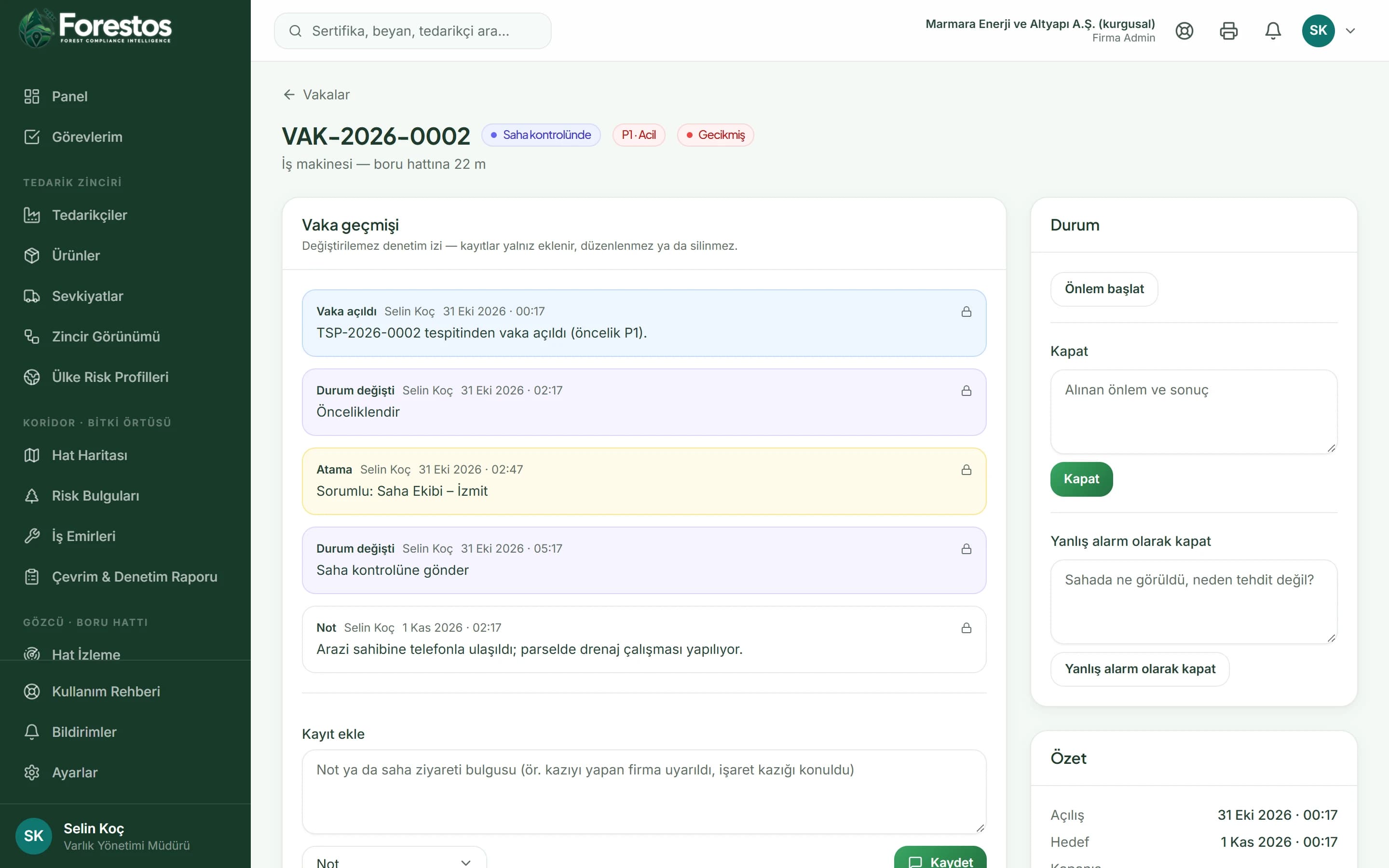
Assignment, field check, notes and mitigation steps sit in the same case; the target time is set by priority.
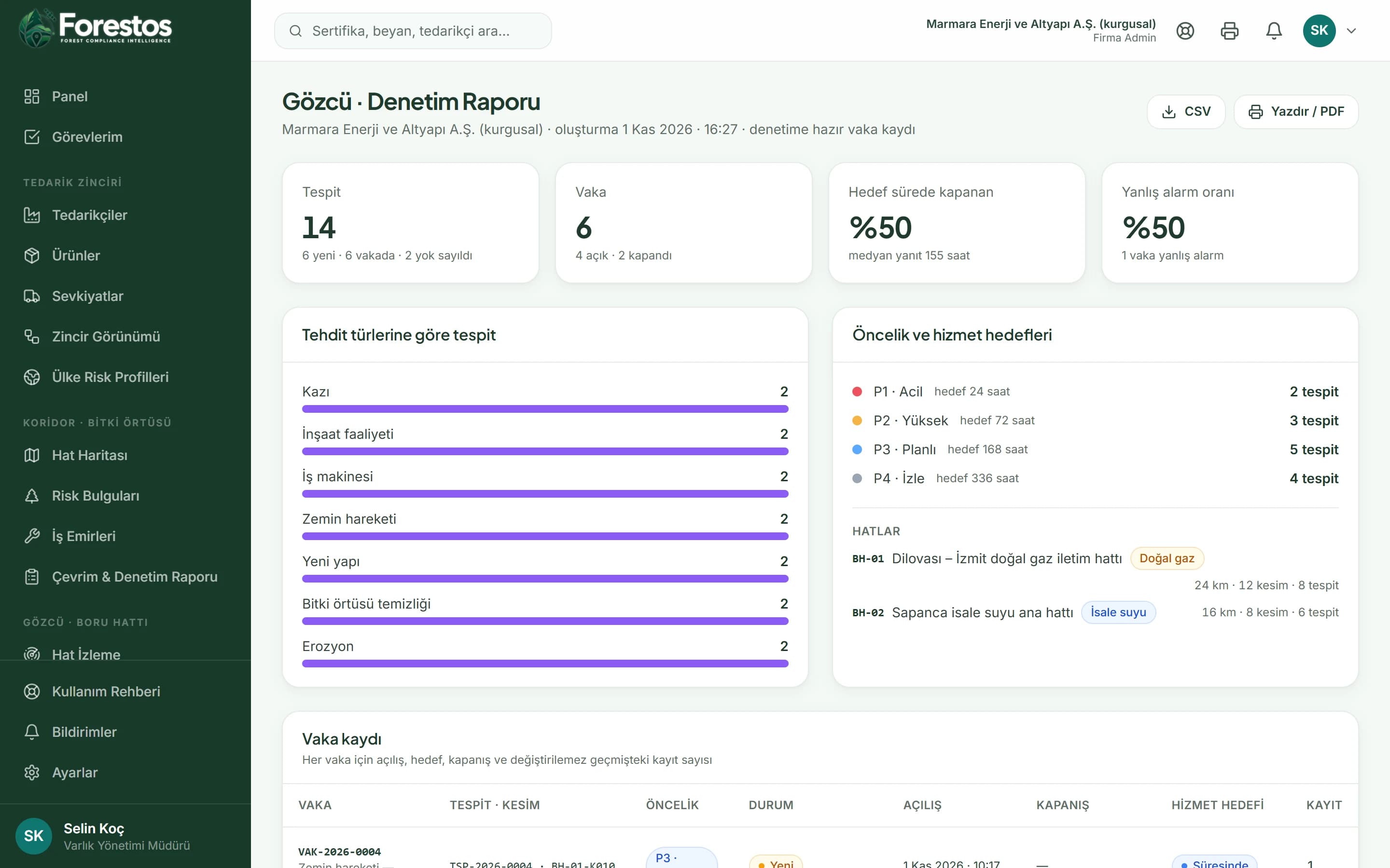
A complete digital audit trail
The case history is append-only and cannot be changed; the report can be printed and downloaded as CSV.
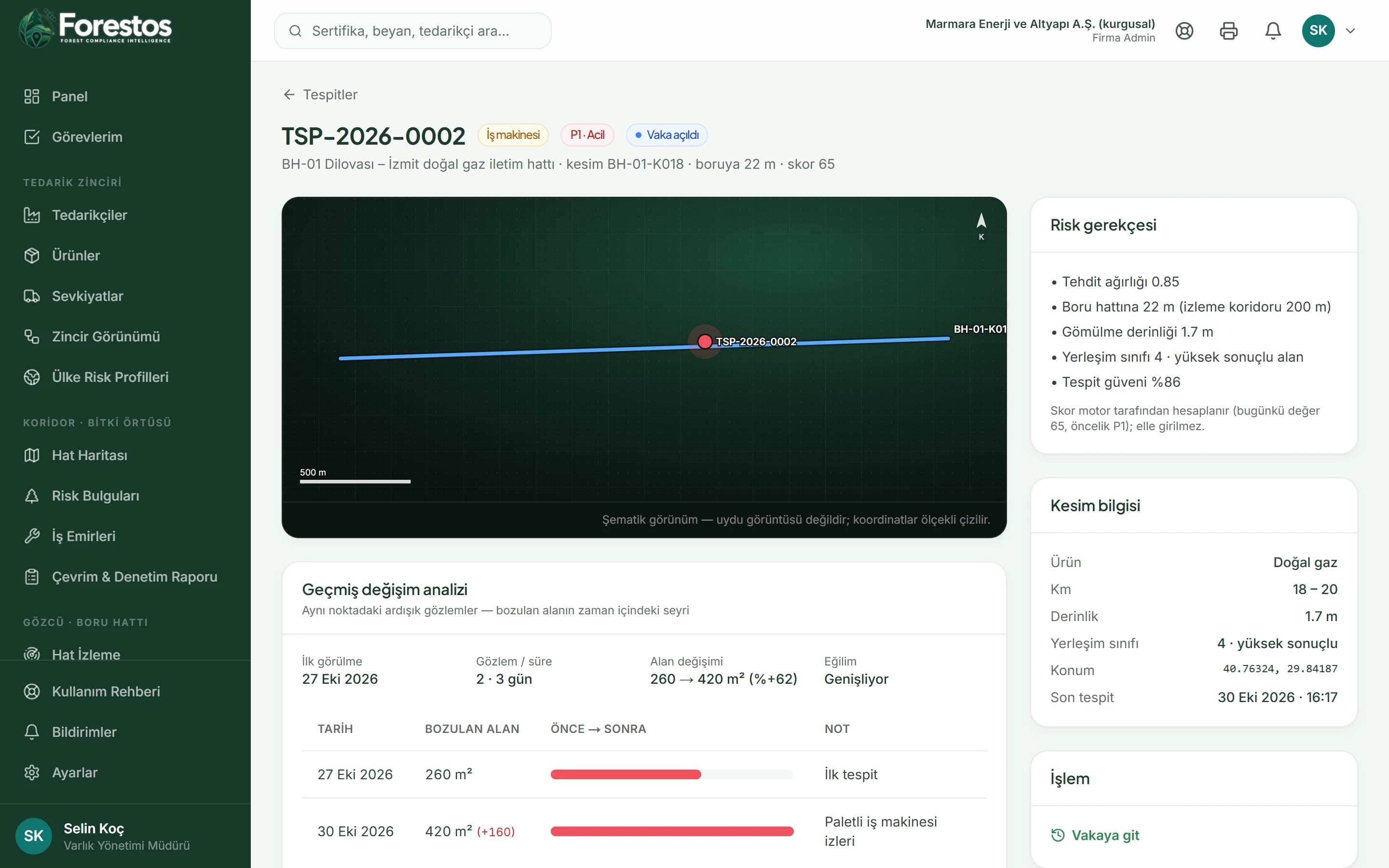
Change history analysis
How a detection's area has grown, and its trend, are visible in the time series from the date it was first seen.
Experience what a smooth Gözcü workflow looks like
Let's plan a walkthrough with your own data.
How does it work?
Change Detection & Prioritisation
Catch hazards before they become emergencies
Case Management
Turn insight into action
Audit Reports
Prove compliance with defensible records
Change History Analysis
Reveal hidden patterns with time series
What changes on your route?
Fewer missed threats
Activity that starts between patrols enters the list with its priority.
Fewer wasted field visits
Low-priority and false-alarm detections are kept apart.
An audit record ready to go
Every case's history and report in the same place.
A patrol logbook, or Gözcü?
| Topic | Patrol + e-mail | With Gözcü |
|---|---|---|
| Detection | Depends on the patrol day | Along the corridor with every scan |
| Prioritisation | Everything equally important | P1-P4 by distance, depth and location class |
| Follow-up | E-mail chains | Cases with status and a target time |
| Audit | Scattered notes | Immutable timeline and report |
Frequently asked questions
The questions teams ask most about Gözcü.
Would you like a short introductory call?
Get in touchWhich threat types does it detect?
Excavation, construction activity, heavy machinery, ground movement, new structures, vegetation clearing and erosion.
How do you handle false alarms?
A detection can be dismissed, or a case closed as a 'false alarm'; the rate is tracked in the report.
Does it monitor natural hazards too?
The ground movement and erosion detection types are aimed at natural-hazard monitoring.