
Gözcü · By use case
See ground movement and erosion in time to act
Monitor landslide, ground slip and erosion detections route by route; read the trend from the time series.
Frameworks we map to
- EUDR
- FSC®
- PEFC
- SBP
- ISO 14001
- GRI
- KVKK
- GeoJSON
- EU Information System (TRACES)
- WGS84
- CSV / REST API
- ISO 27001 control mapping
Nature strains the line too
Slips after rainfall
Heavy rain moves the ground on sloping segments.
Cover being stripped
Erosion can expose a buried line.
Slow change
Small but ongoing changes are easily missed.
Natural hazards with Gözcü
Gözcü's features work together in this scenario.
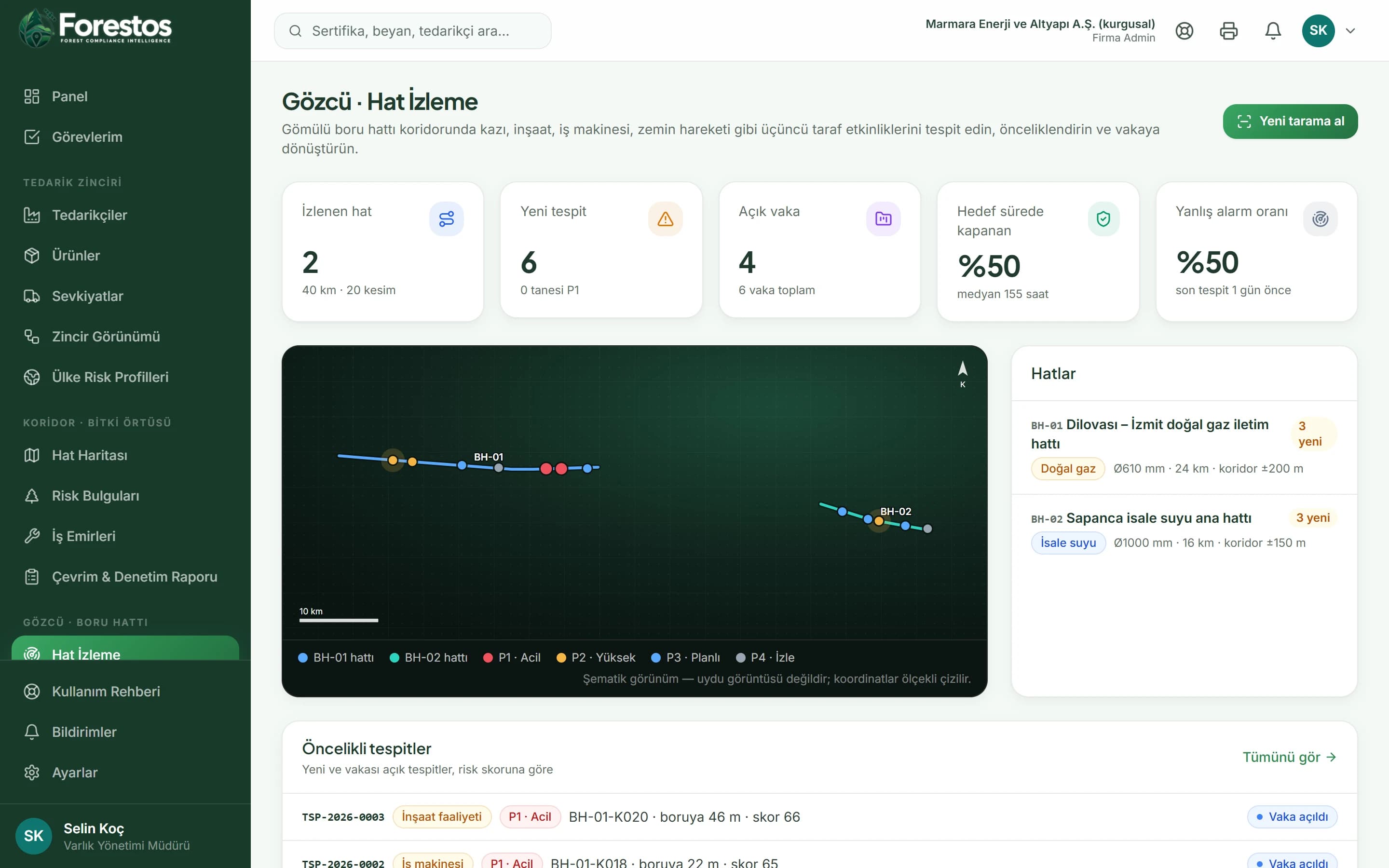
Change Detection & Prioritisation
Catch hazards before they become emergencies
Seven threat types: excavation, construction activity, heavy machinery, ground movement, new structures, vegetation clearing and erosion. On the map every detection is shown in the colour of its priority.
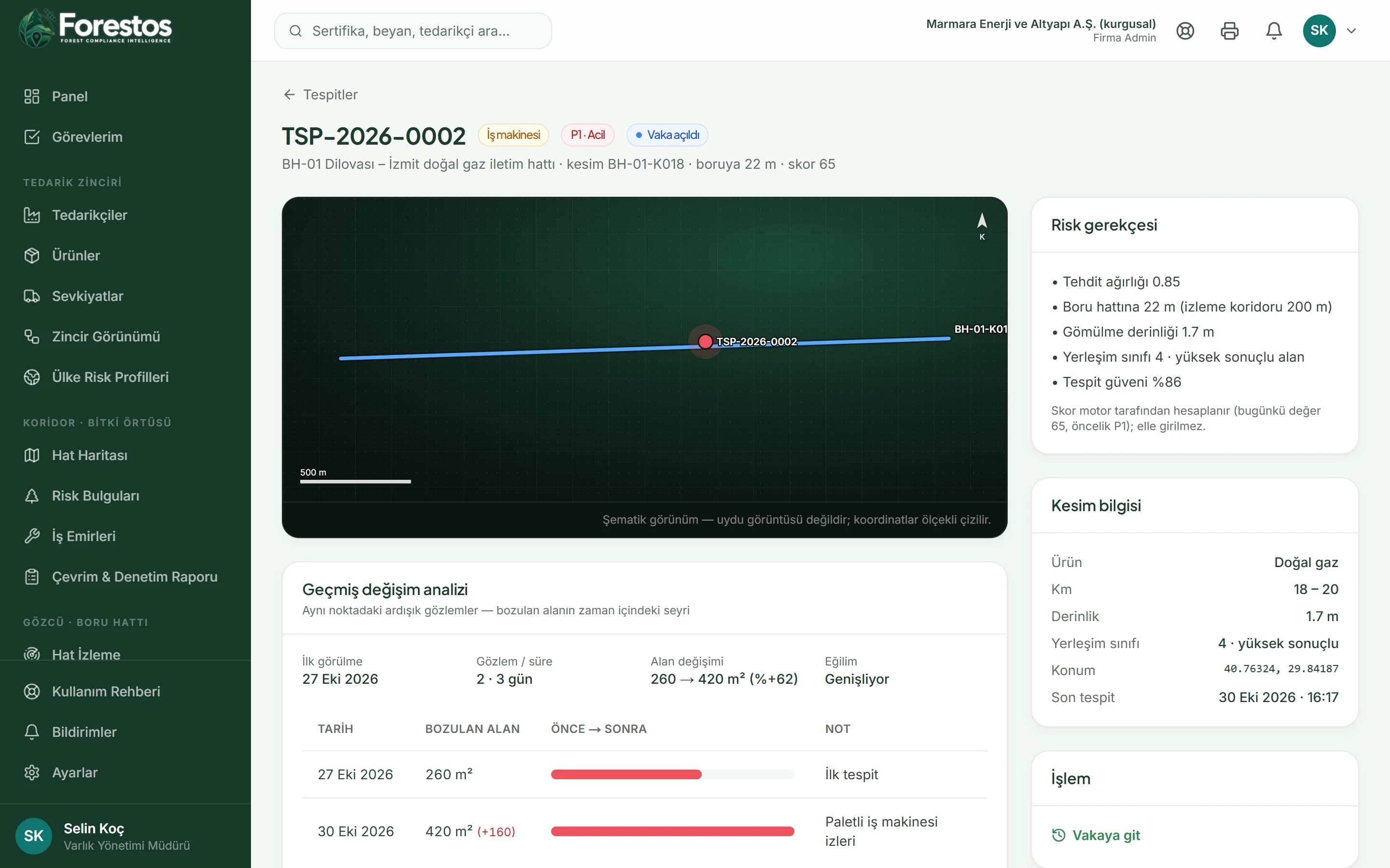
Change History Analysis
Reveal hidden patterns with time series
A before/after table and summary: first sighting, last observation, area change and trend (growing, stable, shrinking).
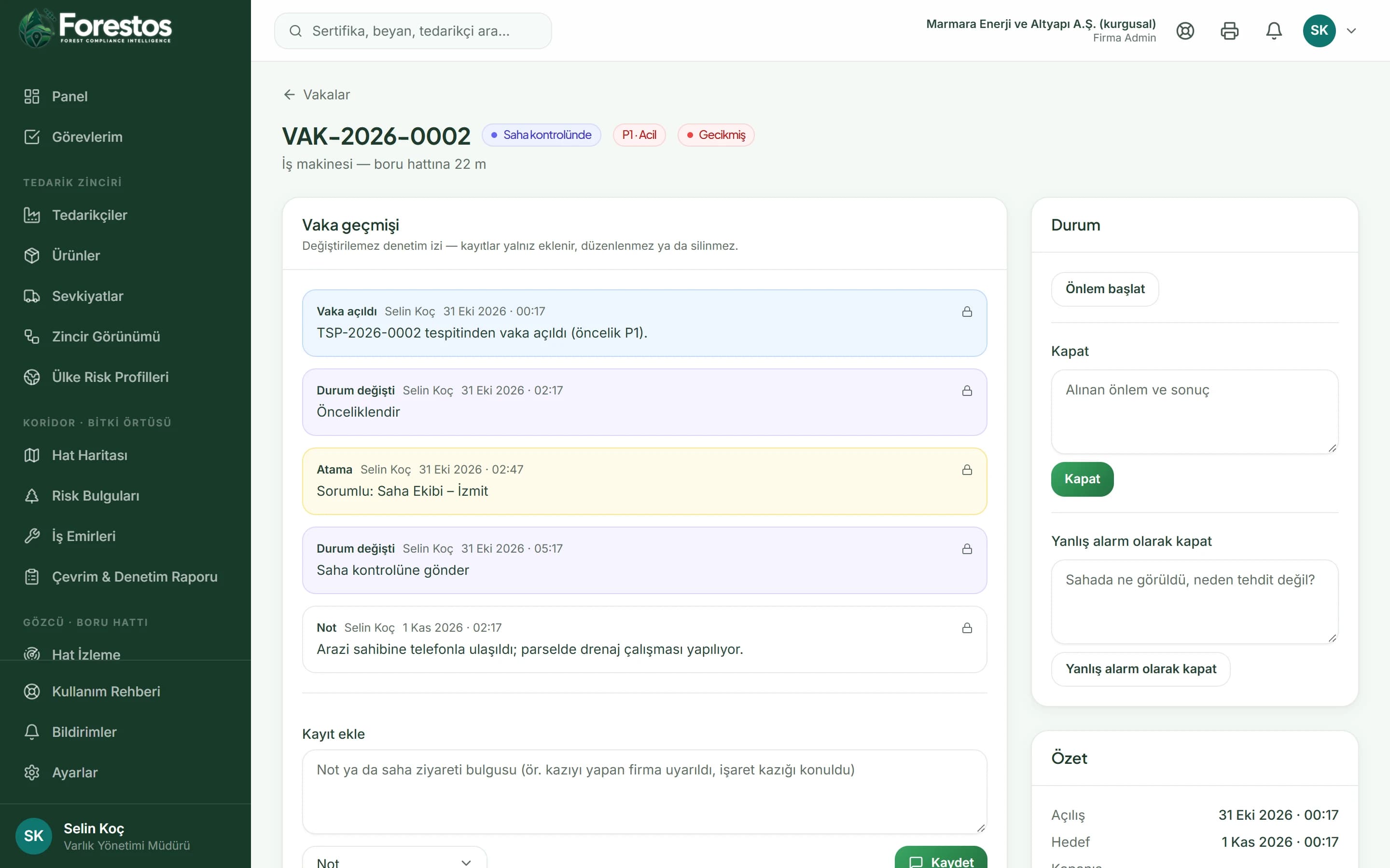
Case Management
Turn insight into action
Every case goes through new → prioritised → field check → mitigation in progress → closed (or false alarm); every change is added to the timeline.
Anticipate natural risks
Frequently asked questions
Frequently asked questions: Natural hazard monitoring.
Would you like a short introductory call?
Get in touchHow is slowly developing change noticed?
The detection's observation series shows the area change and the trend; persistence raises the score.