Gözcü · By industry
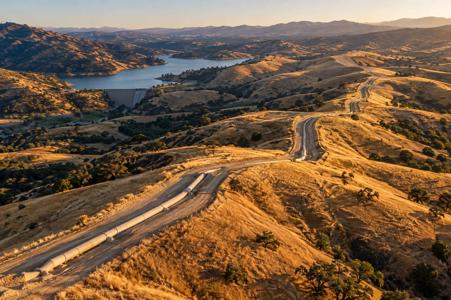
On gas and water lines, monitoring that prevents damage
Monitor new construction and excavation on segments near settlements as a priority; manage field checks with a target time.
Frameworks we map to
- EUDR
- FSC®
- PEFC
- SBP
- ISO 14001
- GRI
- KVKK
- GeoJSON
- EU Information System (TRACES)
- WGS84
- CSV / REST API
- ISO 27001 control mapping
Where is the risk on gas and water lines?
Urban pressure
New construction is increasing around the route.
Infrastructure works
Excavation by other organisations threatens the line.
Ground movement
Landslides and erosion can expose a buried line.
Gas and water lines with Gözcü
Location-class weighting
Priority rises in dense settlement.
Natural hazards
Ground movement and erosion detections.
Target time
A due date by priority.
How does it work?
Gözcü's features work together in this scenario.
Change Detection & Prioritisation
Catch hazards before they become emergencies
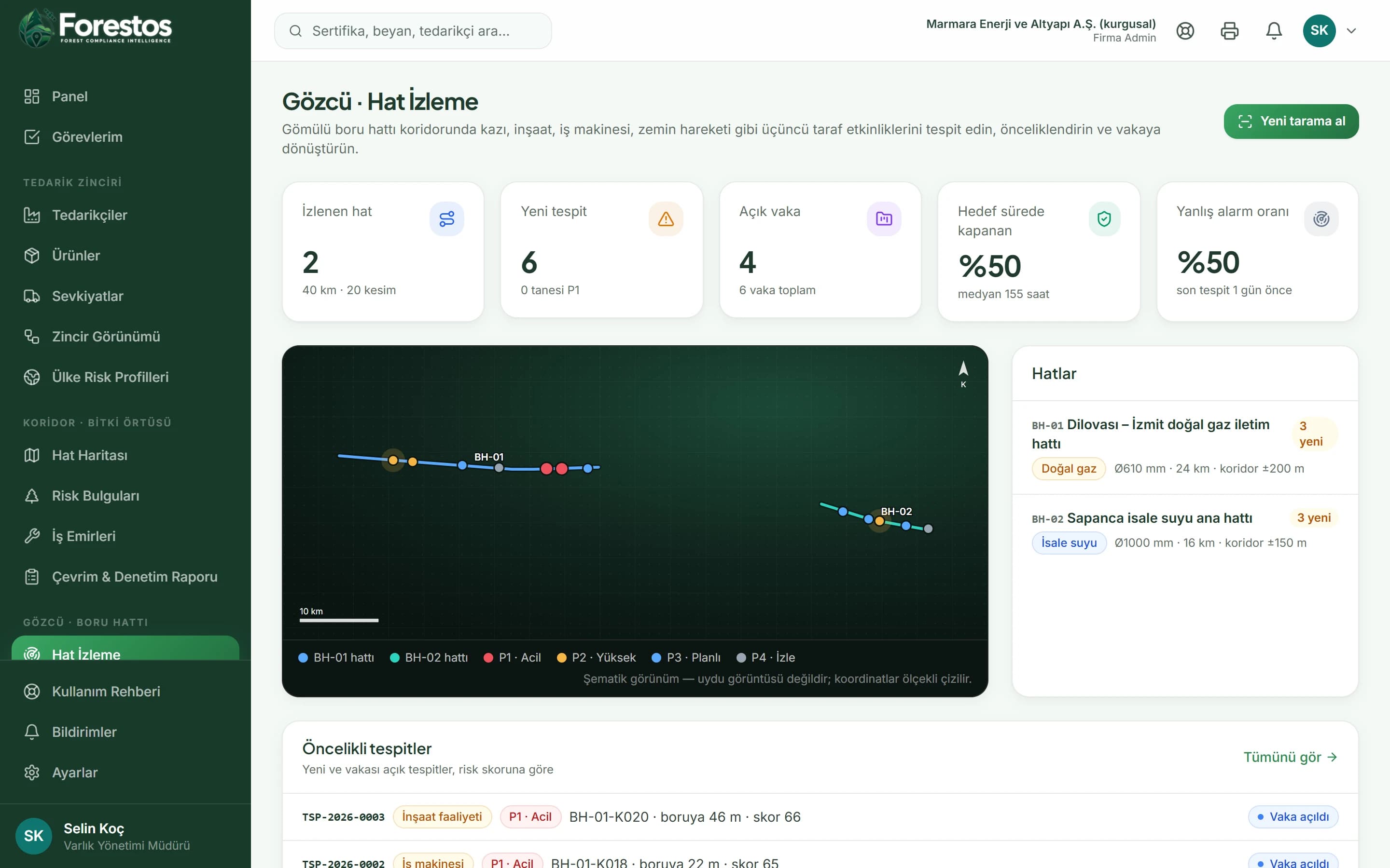
Seven threat types: excavation, construction activity, heavy machinery, ground movement, new structures, vegetation clearing and erosion. On the map every detection is shown in the colour of its priority.
Case Management
Turn insight into action
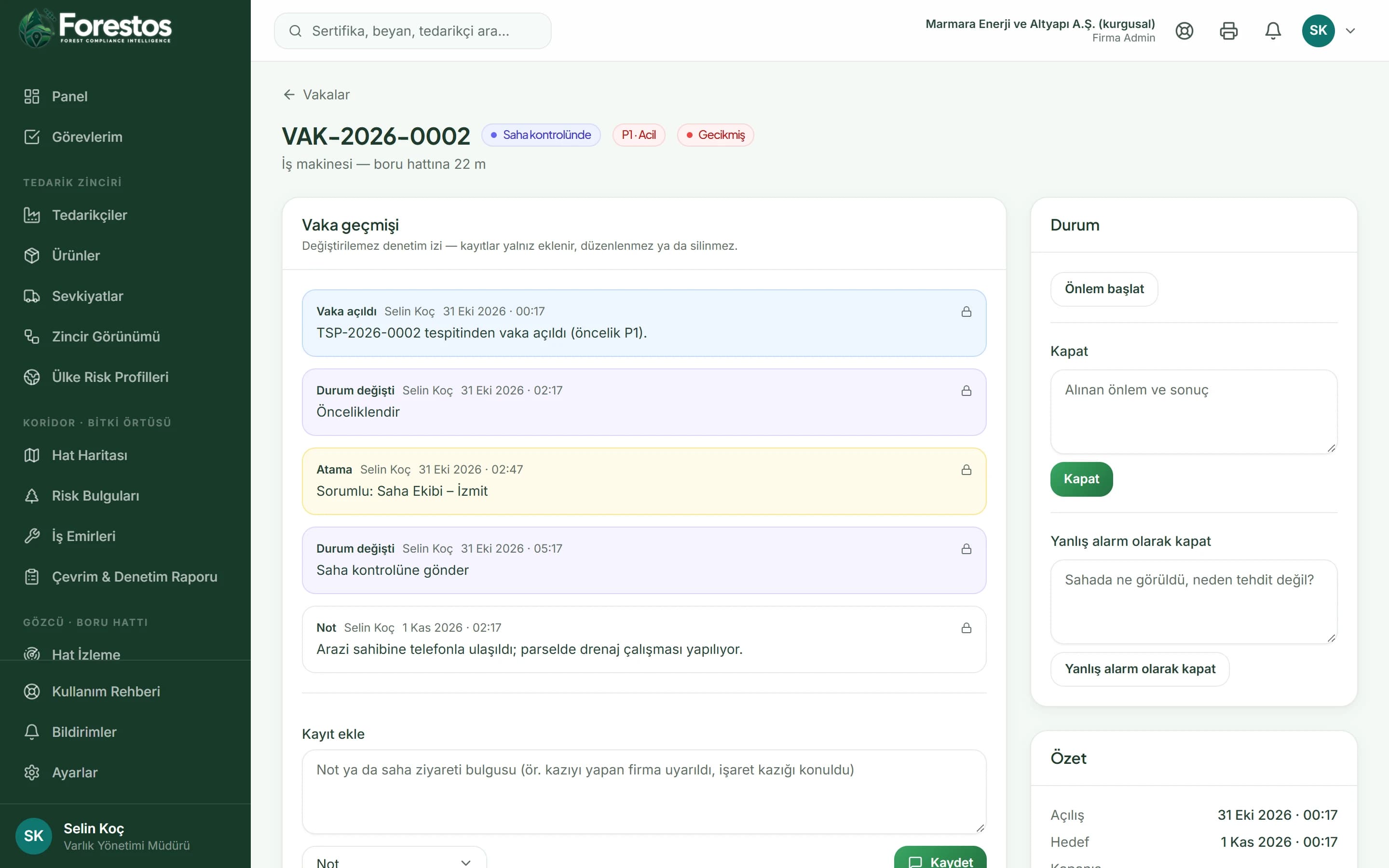
Every case goes through new → prioritised → field check → mitigation in progress → closed (or false alarm); every change is added to the timeline.
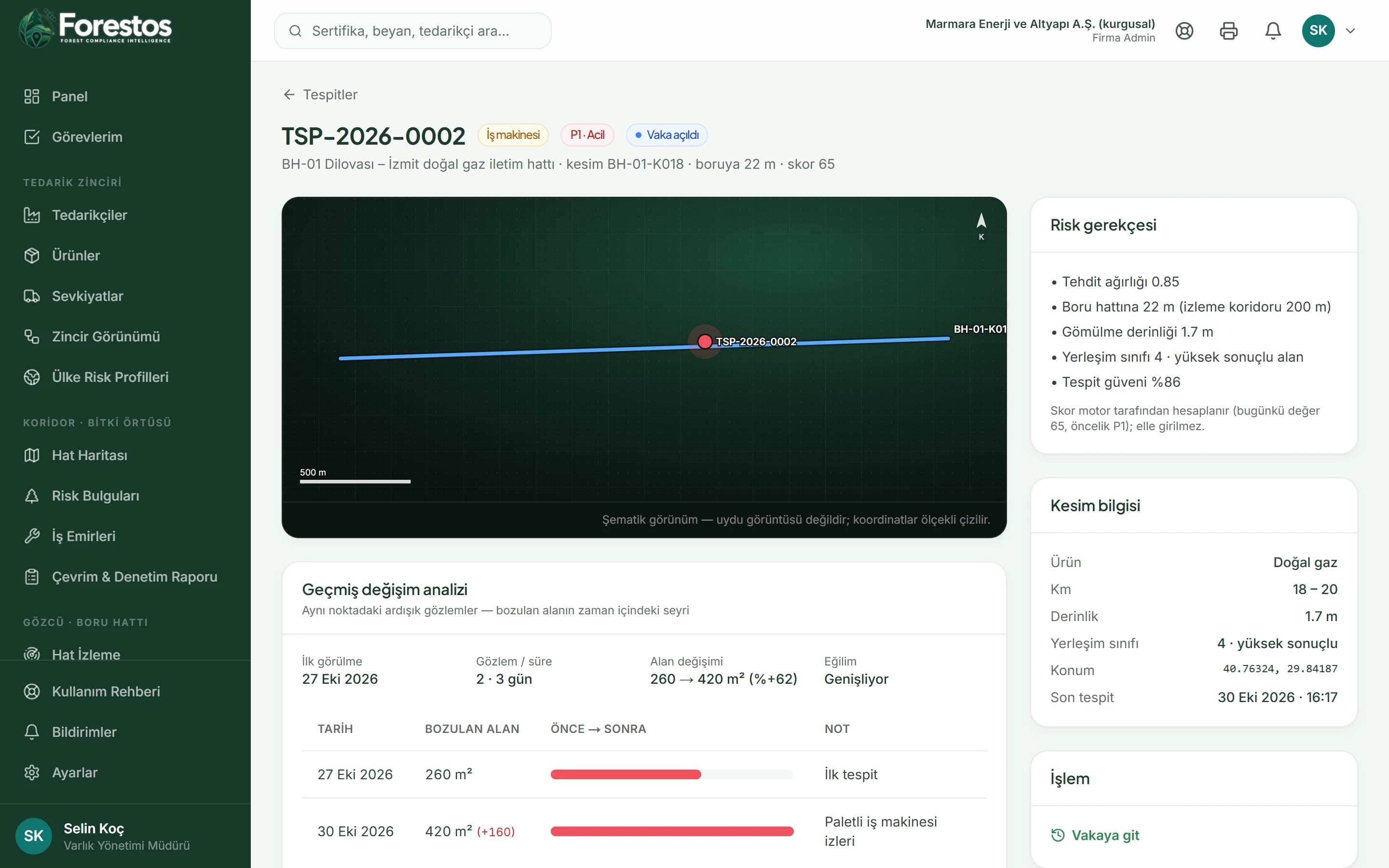
Change History Analysis
Reveal hidden patterns with time series
A before/after table and summary: first sighting, last observation, area change and trend (growing, stable, shrinking).
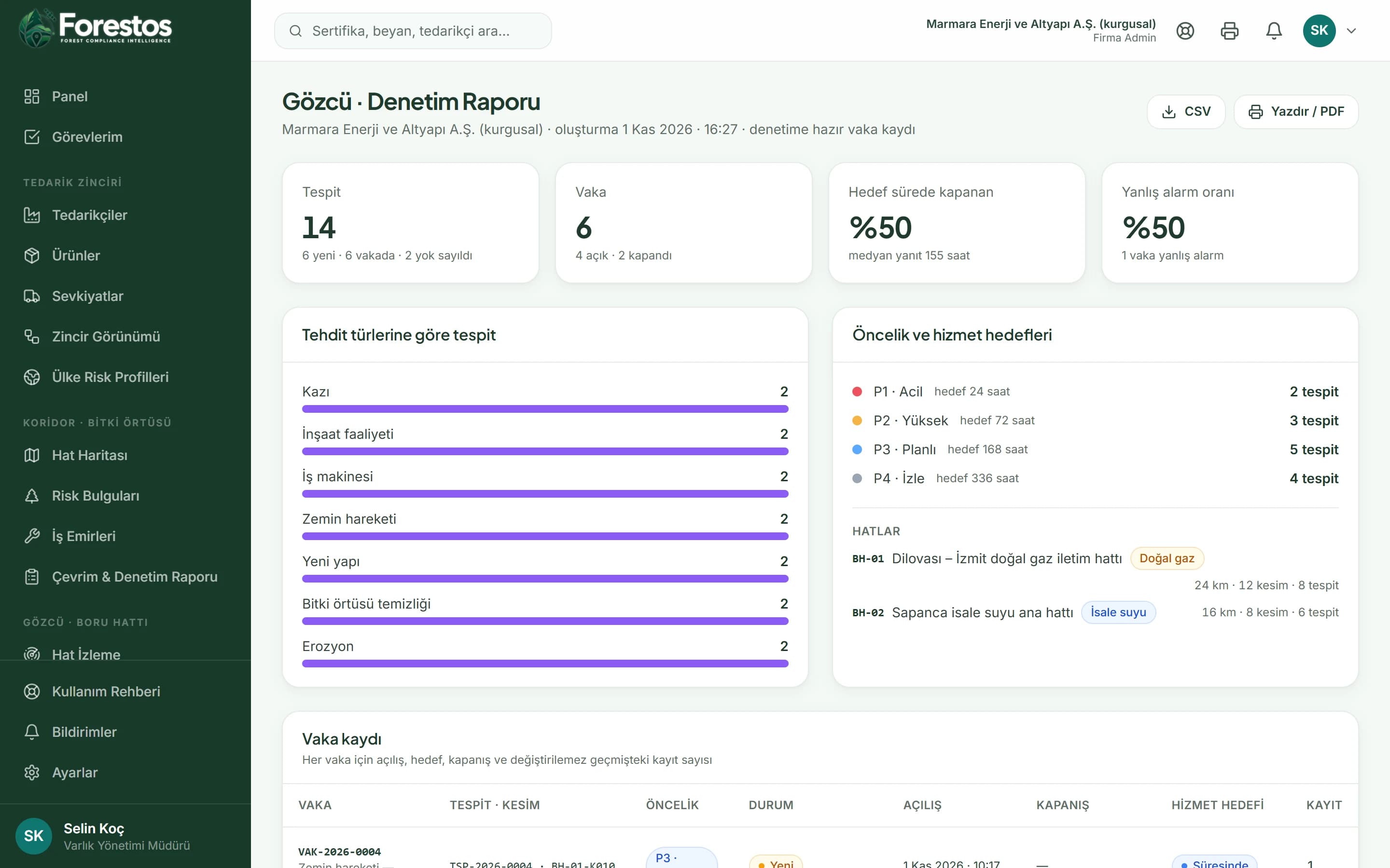
Audit Reports
Prove compliance with defensible records
The report is built only from the detection and case records in the app; every figure can be traced back to its record.
Protect your line amid urban growth
Frequently asked questions
Frequently asked questions: Gas and water transmission lines.
Would you like a short introductory call?
Get in touchIs it suitable for water transmission lines too?
Yes; the pipeline product can be defined as 'water main'.